“The Conflict Site Dataset is an extension to the UCDP/PRIO Armed Conflicts Dataset that provides coordinates for the conflict zones and lists of countries in which the conflicts were located. Following the procedure of earlier versions of the UCDP/PRIO data (up until v. 3-2005), the conflict zones are coded with center-point coordinates plus a radius variable to denote spatial extent. See codebook for further information. For a longer time-span from 1946-2005, see version 2.” (https://www.prio.org/data/5, 17/09/2023)
“The new version (3.0) of the PRIO Conflict Site dataset is totally revised and recoded update that corresponds to the latest available version of the UCDP/PRIO Armed Conflict Dataset (Version 4-2010) (Gleditsch et al., 2022).2 […] 2 The UCDP/PRIO Armed Conflict Dataset defines a conflict as ‘a contested incompatibility that concerns government and/or territory where the use of armed force between two parties, of which at least one is the government of a state, results in at least 25 battle-related deaths‘ (Harbom et al., 2009).” (codebook, p. 2)
I/2/ Conflict domain
State-based conflict
Non-state conflict
One-sided violence
TO BE DETERMINED
∅
∅
∅
X
II/ Time variable II/1/ Unit of time
Day
Year
∅
X
“Year Year of observation.” (codebook, p. 4)
II/2/ Time domain
Time domain
1989 – 2008
“The time period covered is 1989-2008.” (codebook, p. 2)
III/ Space variable III/1/ Unit of space
Coordinates
Country
Region
TO BE DETERMINED
X
∅
∅
∅
“Latitude The geographical center of the conflict zone is given as decimal degrees where southern latitudes and western longitudes have negative values. Longitude See latitude.” (codebook, p. 4)
“One of the major improvements is that the data are structured in a conflict-year format, thereby adding a temporal – dynamic – aspect lacking in previous version.” (codebook, p. 2)
(ConflictSite 4-2010_v3 Dataset.xls, 24/08/2022)
IV/2/ Number of observations
Number of observations
791
(ConflictSite 4-2010_v3 Dataset.xls, 24/08/2022)
V/ All variables
Conflictname
Conflict type
Intensity
X
∅
∅
Outcome
Time
Space
∅
X
X
Actor
Type of actor
Dyad
∅
∅
∅
Coalition
Deaths
Non-conflit variables
∅
∅
∅
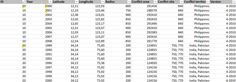
“ID Conflict identifier in the UCDP/PRIO Armed Conflict Dataset. Year Year of observation. Latitude The geographical center of the conflict zone is given as decimal degrees where southern latitudes and western longitudes have negative values. Longitude See latitude.” (codebook, pp. 3-4)
VI/ Transparency VI/1/ Sources
Intergovernmental organizations
Governmental organizations
Non-governmental organizations
∅
∅
∅
Research organizations
Pressmedia
Social media
∅
X
∅
Other databases
OTHER
TO BE DETERMINED
X
X
X
“The new version (3.0) of the PRIO Conflict Site dataset is totally revised and recoded update that corresponds to the latest available version of the UCDP/PRIO Armed Conflict Dataset (Version 4-2010) (Gleditsch et al., 2022). […] In addition, a wider range of sources than in earlier versions have been used, including news reports from Factiva and a generous selection of case-specific literature. Moreover, the use of geographic information systems (GIS) software and databases has increased the precision in the geo-referenced coding.” (codebook, p. 2)
“The new version (3.0) of the PRIO Conflict Site dataset is totally revised and recoded update that corresponds to the latest available version of the UCDP/PRIO Armed Conflict Dataset (Version 4-2010) (Gleditsch et al., 2022).” (p. 2) “Updated: 1 May 2011” (https://www.prio.org/data/5, 17/09/2023)
We use cookies to ensure that we give you the best experience on our website. If you continue to use this site we will assume that you are happy with it.