
“The Conflict Site Dataset is an extension to the UCDP/PRIO Armed Conflicts Dataset that provides coordinates for the conflict zones and lists of countries in which the conflicts were located. Following the procedure of earlier versions of the UCDP/PRIO data (up until v. 3-2005), the conflict zones are coded with center-point coordinates plus a radius variable to denote spatial extent. See codebook for further information.
For a longer time-span from 1946-2005, see version 2.” (https://www.prio.org/data/5, 17/09/2023)
I/ Conflict variable
I/1/ Unit of conflict
| Event (< 0 or 1 death) | Conflict (< 25 deaths) | War (< 100 deaths) | Episode (< 500 deaths) |
|---|---|---|---|
| ∅ | X | ∅ | ∅ |
I/2/ Conflict domain
| State-based conflict | Non-state conflict | One-sided violence | TO BE DETERMINED |
|---|---|---|---|
| ∅ | ∅ | ∅ | X |
II/ Time variable
II/1/ Unit of time
| Day | Year |
|---|---|
| ∅ | X |
The year of the observation.” (codebook, p. 4)
II/2/ Time domain
| Time domain |
|---|
| 1946 – 2005 |
III/ Space variable
III/1/ Unit of space
| Coordinates | Country | Region | TO BE DETERMINED |
|---|---|---|---|
| X | ∅ | ∅ | ∅ |
The latitude and longitude variables indicate the geographical midpoint of the conflict zone. The coordinates are given as decimal degrees where southern latitudes and western longitudes have negative values. For larger conflict zones, the coordinates are rounded to the nearest 1/4th decimal degree. For conflicts that took place within a single spot (military base, village, city, etc.), the variables provide coordinates exact to the nearest decimal.
Longitude
See Latitude.” (codebook, p. 5)
III/2/ Space domain
| Global | Mediterranean Sea and Sahel | TO BE DETERMINED |
|---|---|---|
| X | ∅ | ∅ |
(Conflict Site 4-2006.xls, 05/08/2016)
IV/ Data structure
IV/1/ Unit of observation
| Unit of conflict (UC) | UC-year | UC-actor | Country-year |
|---|---|---|---|
| ∅ | ∅ | ∅ | ∅ |
| Actor-year | Dyad-year | OTHER | TO BE DETERMINED |
|---|---|---|---|
| ∅ | ∅ | ∅ | X |
(Conflict Site 4-2006.xls, 05/08/2016)
IV/2/ Number of observations
| Number of observations |
|---|
| 1 842 |

(Conflict Site 4-2006.xls, 05/08/2016)
V/ All variables
| Conflict name | Conflict type | Intensity |
|---|---|---|
| X | ∅ | ∅ |
| Outcome | Time | Space |
|---|---|---|
| ∅ | X | X |
| Actor | Type of actor | Dyad |
|---|---|---|
| ∅ | ∅ | ∅ |
| Coalition | Deaths | Non-conflit variables |
|---|---|---|
| ∅ | ∅ | ∅ |
The conflict identifier of the conflict to which the observation belongs, as de-fined by Harbom et al. (2006).” (codebook, p. 4)
“Year
The year of the observation.” (codebook, p. 4)
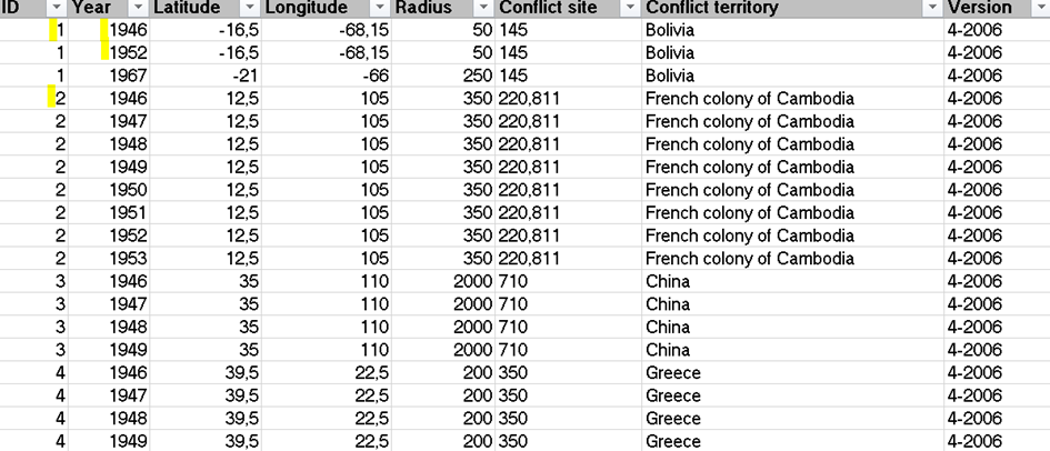
“Latitude
The latitude and longitude variables indicate the geographical midpoint of the conflict zone. The coordinates are given as decimal degrees where southern latitudes and western longitudes have negative values. For larger conflict zones, the coordinates are rounded to the nearest 1/4th decimal degree. For conflicts that took place within a single spot (military base, village, city, etc.), the variables provide coordinates exact to the nearest decimal.
Longitude
See Latitude.
Radius
The radius variable indicates the largest geographic extent of the conflict zone from the center point during the course of conflict. The radius variable is measured in 50-kilometer intervals. For conflicts that took place within a sin-gle spot (military base, village, city, etc.), the radius variable is set at 50 km.
Conflict Site
Gleditsch & Ward (1999) country code as defined by the parent dataset’s sys-tem membership definition for the country/countries within which the conflict took place.
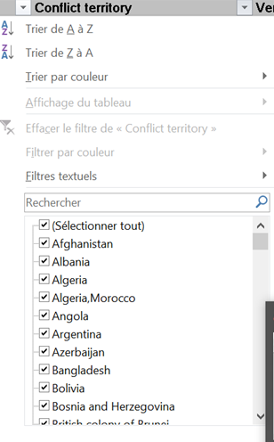
Conflict Territory
Name(s) of country/countries listed in the Conflict Site variable.” (codebook, p. 5)
VI/ Transparency
VI/1/ Sources
| Intergovernmental organizations | Governmental organizations | Non-governmental organizations |
|---|---|---|
| ∅ | ∅ | ∅ |
| Research organizations | Press media | Social media |
|---|---|---|
| ∅ | ∅ | ∅ |
| Other databases | OTHER | TO BE DETERMINED |
|---|---|---|
| X | X | ∅ |
gnswww.nga.mil/geonames/GNS/
maps.google.com
www.confluence.org/search.php
www.fallingrain.com” (codebook, p. 3)
“Version
Version number of the corresponding UCDP/PRIO Armed Conflict Dataset. The data are currently updated through 2005 (Version 4-2006b), based on the data presented in Harbom, Högbladh & Wallensteen (2006). This dataset is uniquely referenced to the parent data on the combination of ID and Year.” (codebook, p. 5)
VI/2/ Codebook
| Date | Version |
|---|---|
| 17/10/2006 | 2.0 |
VII/ Update
VII/1/ Current version
| Date | Version |
|---|---|
| 2006 | 2.0 |
Centre for the Study of Civil War, PRIO
[…]
1 The original coding of this dataset was made by Clionadh Raleigh in the fall of 2004. Some smaller adjustments were made by David Cunningham in the fall of 2005 and additional up-dates by Lars Wilhelmsen in the fall of 2006. We are grateful to Halvard Buhaug, Kristian Skrede Gleditsch, Håvard Hegre, and Håvard Strand for comments on earlier drafts” (p. 1)
“The Conflict Site Dataset is an extension to the UCDP/PRIO Armed Conflicts Dataset that provides coordinates for the conflict zones and lists of countries in which the conflicts were located. Following the procedure of earlier versions of the UCDP/PRIO data (up until v. 3-2005), the conflict zones are coded with center-point coordinates plus a radius variable to denote spatial extent. See codebook for further information.
For a longer time-span from 1946-2005, see version 2.” (https://www.prio.org/data/5, 17/09/2023)
VII/2/ Regularly updated ?
| Real-time | Month | Quarter | Annually |
|---|---|---|---|
| ∅ | ∅ | ∅ | ∅ |
| YES, PERIOD TO BE DETERMINED | TO BE DETERMINED |
|---|---|
| ∅ | X |
VIII/ Access
VIII/1/ Registration ?
| YES | NO |
|---|---|
| ∅ | X |
VIII/2/ Formats
| .XLS/.XLSX | .CSV | .DTA (STATA) | .RDTA |
|---|---|---|---|
| X | ∅ | ∅ | ∅ |

(Conflict Site 4-2006.xls, 05/08/2016)
VIII/3/ API ?
| YES | NO | TO BE DETERMINED |
|---|---|---|
| ∅ | ∅ | X |